Turning Security Incidents into Safer Journey Decisions

Building an operational decision-support system for journey management in Afghanistan, combining historical security incidents, geospatial analysis, predictive time patterns and live fleet information to identify lower-risk routes and safer time windows for road movements.

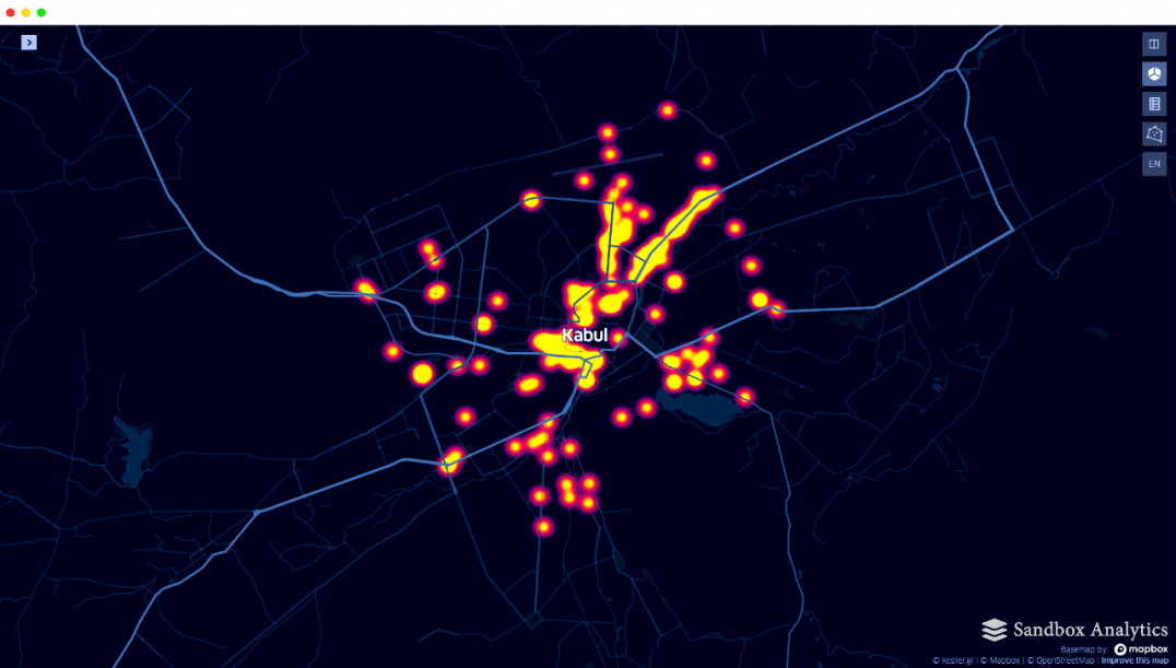
Security incident data architecture
Built a secure evidence base that fused multiple security and operational data sources, improving both the speed and consistency of incident analysis.
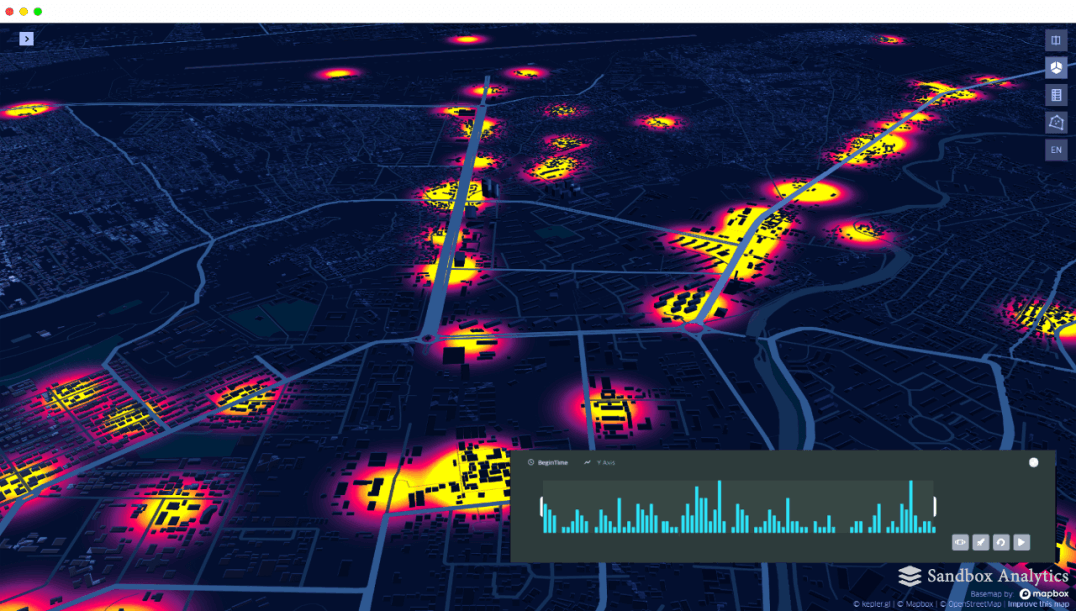
Security incident visualisation
Turned complex incident data into interactive 3D visualisations, helping operational teams understand where security events were concentrated and communicate risk more clearly during briefings.
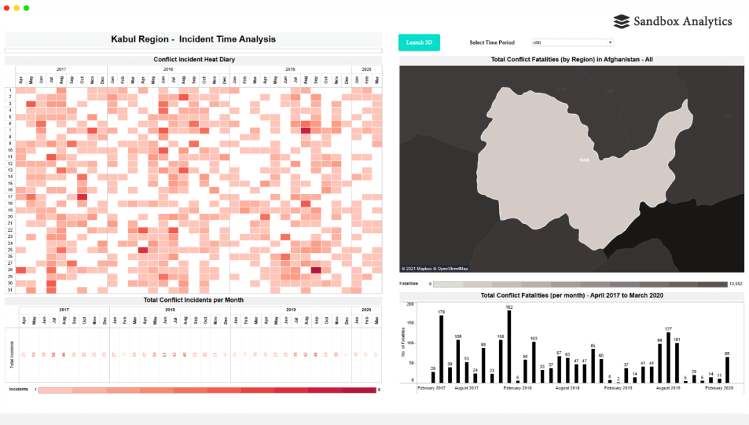
Journey risk time pattern analysis
Analysed 36 months of historical incidents to identify recurring time patterns and safer movement windows, adding predictive evidence to journey planning.
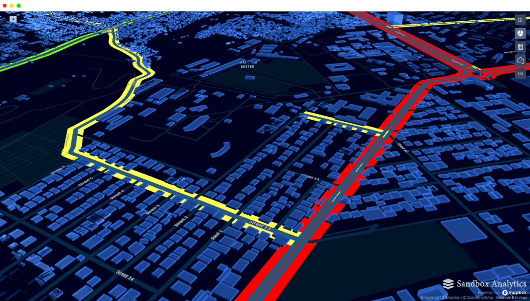
Journey route risk analysis
Applied geospatial analysis and route-risk classification to compare alternative journeys and identify lower-risk options through complex urban environments.
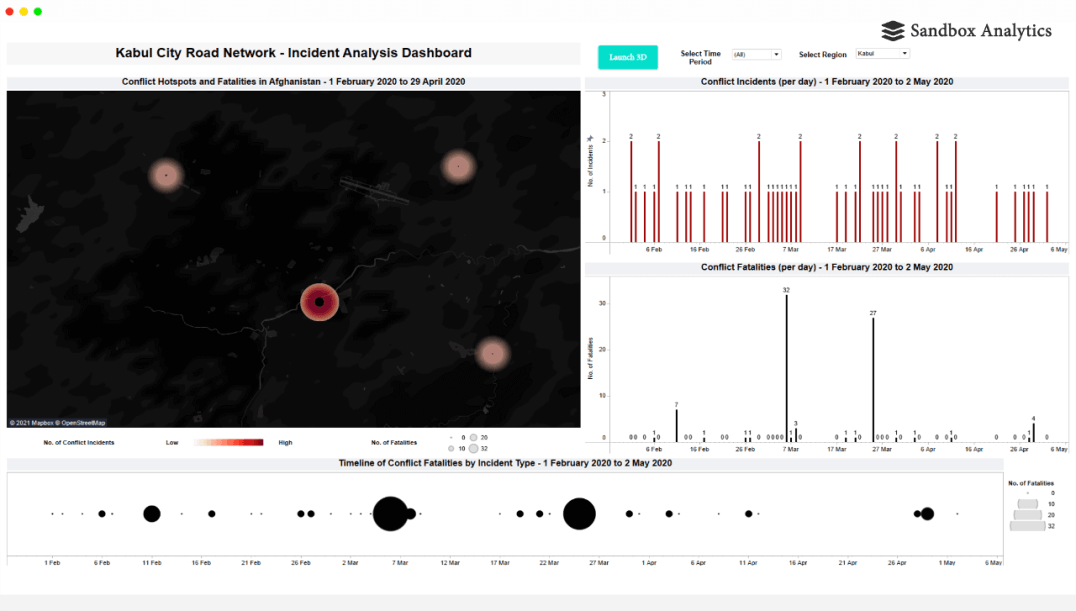
Operational risk dashboard and fleet tracking
Combined risk dashboards with fleet GPS information to give security managers a shared operational picture before and during road movements.
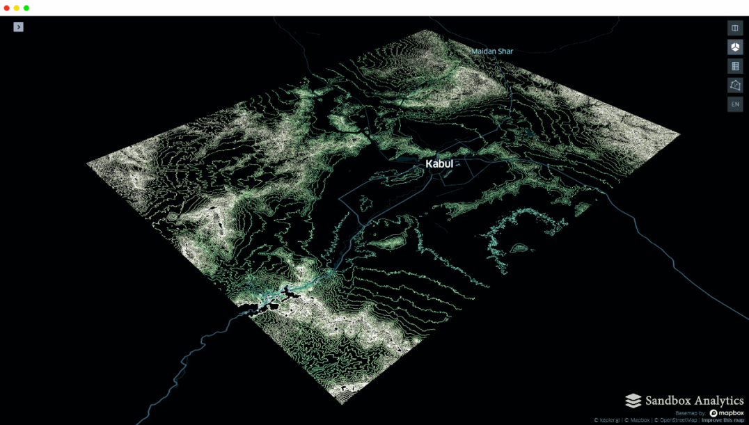
Terrain and communications analysis
Added terrain and communications analysis for longer-distance journeys, reducing uncertainty where route choice, visibility and communications coverage all influenced the decision.

Decision Outcome

The project turned fragmented security reporting into a repeatable journey decision system. Historical incident patterns, route analysis, time-of-day risk, terrain and live fleet information could be considered together, giving security managers a stronger evidence base for deciding whether, when and how road movements should take place. The result was better situational awareness, more consistent journey planning and reduced uncertainty in a high-risk operating environment.

See More Selected Work